Brussels Metro Map
On this page, you can find the Brussels metro map available for both printing and downloading in PDF format.
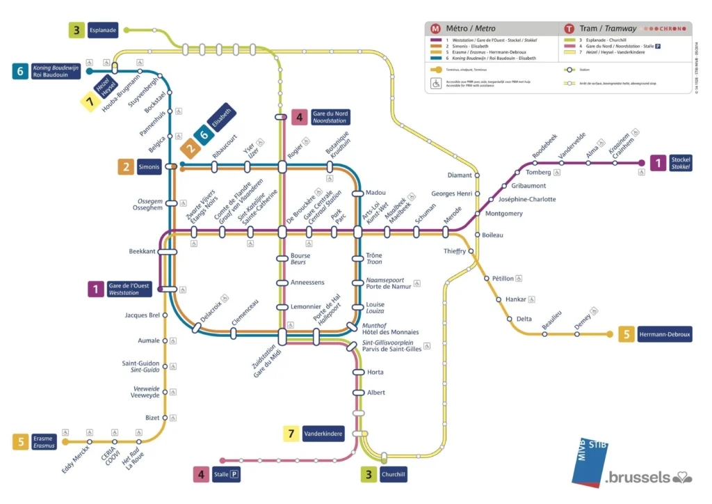
Map of Brussels metro
Brussels Metro Lines
- Line 1 (Blue)
- Connects Gare de l’Ouest to Stockel
- Passes through central Brussels with key stations like De Brouckère, Gare Centrale, and Mérode.
- Line 2 (Orange)
- Operates as a loop around the city center
- Connects Simonis (Leopold II) to Simonis (Elisabeth) via important stations like Louise, Porte de Namur, and Trône.
- Line 5 (Yellow)
- Connects Erasme to Herrmann-Debroux
- Shares a significant portion of its route with Line 1, especially in central Brussels.
- Line 6 (Pink)
- Connects Roi Baudouin to Simonis (Elisabeth)
- Shares part of its route with Line 2 in the central loop.
Using the Map
The Brussels Metro Map is designed to be easy to read and understand. The lines are clearly marked by distinct colors, and each station is indicated by a dot. Interchanges between lines are also clearly signposted, allowing passengers to switch lines easily.